The Strip You Don't Spray
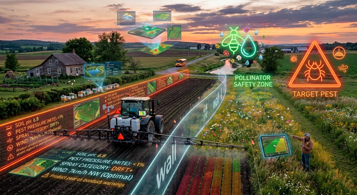
Every field has an edge, and on the other side of that edge there is something: a watercourse, a house, a road, the neighbour's parcel with a different crop, a school, beehives. The buffer zone is the strip you leave untreated so that whatever is on the other side stays fine.
It is the part of the job that does not show on the invoice, and the first thing anyone examines when a complaint arrives.
Where the distance comes from
Three sources, and all three matter.
The label. Many products specify minimum distances to water bodies, dwellings or sensitive crops. When the label states a number, that number is mandatory and leaves no room for your own judgement.
Local regulation. Municipalities, provinces and countries impose their own setbacks from populated areas, schools, watercourses and protected zones. They are often stricter than the label and they change over time.
Your technical judgement on the day. When neither of the above applies, the responsibility is yours. A distance that is enough at 5 km/h in a safe direction is not enough at 15 km/h blowing towards the neighbour's house.
What moves the distance you need
- Wind direction and speed. A downwind buffer has to be far wider than an upwind one — and direction shifts during the day.
- Droplet size. Your most direct lever: one coarser droplet category cuts the fraction that can travel.
- Application height. The higher the spray is released, the longer it stays airborne.
- Atmospheric stability. Under a thermal inversion, drift does not dilute: it stays concentrated and travels far. It is the condition in which normal distances stop working.
- What is on the other side. A dirt track with no traffic is not the same as an apiary, a greenhouse, a certified organic crop or a crop that is especially sensitive to the product you are applying.
The sensitive neighbour. Certified organic crops, seed production, greenhouses and apiaries deserve a conversation before the season, not a warning on the day. Knowing where they are, having them marked on the field map and coordinating with their owners prevents almost every conflict — and conflicts of this kind end in lost certification or a lawsuit, not a discussion.
How things get left in the field
Defining the zone is half of it. The other half is making it exist in reality and not only in intention:
- Mark the boundary before you start. On guided equipment, load it as an excluded area. If not, mark it physically. A boundary that lives only in the operator's head drifts on its own four hours into the day.
- Decide what happens to that strip. Does it stay untreated? Is it treated with another technique, in different wind, or with a coarser droplet? The grower needs to know, because it is ground that did not get the treatment and will behave differently.
- Charge it or deduct it, but say so. If the area actually treated is smaller than the field, that difference belongs on the work order. It is commercial honesty, and it is also the explanation for why that strip had more pest pressure afterwards.
Documentation: what to record and why
A drift complaint arrives weeks later, once the damage has shown up in the neighbour's crop. At that point there is nothing left to observe in your favour: there is only what was written down on the day of application.
The minimum that should be on record per job:
- Actual conditions at the time of application: wind speed and direction, temperature and humidity, with the time.
- The buffer distance left at each sensitive boundary, and the reasoning that set it.
- A sketch or map of the area actually treated, with excluded zones marked.
- The equipment setup: droplet category, height, pressure.
- The notifications you gave and to whom, with dates.
That set is what turns "I left the distance" into a documented fact. It is not defensive paperwork: it is the difference between arguing your word against the neighbour's and producing a time-stamped record.
The record is made before, not after. A sketch drawn on the day of the complaint is worth nothing, and it shows. The record has value precisely because it was created before anyone knew it would be needed.
What the careful operator gains
There is a defensive reading of all this — covering yourself — and it is valid. But there is a more useful one: in many regions social and regulatory pressure on pesticide application keeps rising, and the operators who survive that pressure are the ones who can demonstrate how they work. A file per job, with conditions, distances and a map, is what lets you keep operating near populated areas when others get restricted.
In short: the distance is set first by the label, then by local regulation, and finally by your judgement given the day's conditions. Mark it before you start, decide and communicate what happens to that ground, and write down the wind, the distance, the map and the setup. The day someone complains, that record is the only thing that will exist.
General guidance only. Mandatory setbacks vary by product, jurisdiction and type of protected area. Always follow the label and local regulations, and consult your local agricultural authority.
Sources: University of California Statewide IPM Program; Penn State Extension; University of Nebraska-Lincoln Extension; Montana State University Pesticide Education Program.