Kp Index: When It Can Ruin Your Spraying
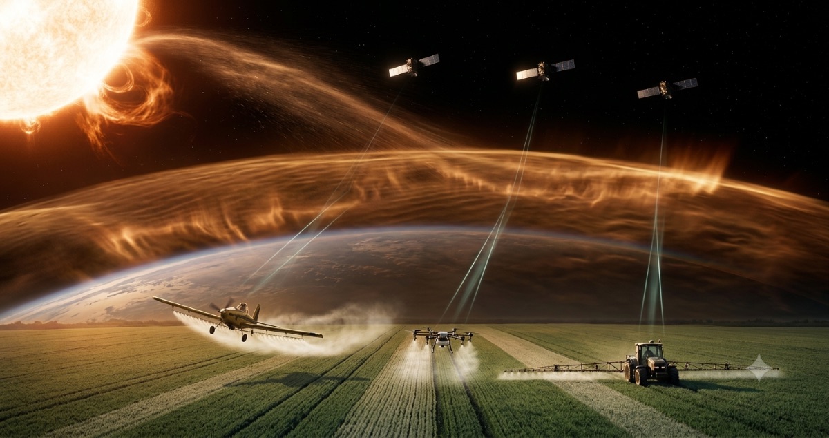
There is a kind of bad day that shows up in no weather report.
The weather was perfect. Wind in range, Delta T correct, no rain, no inversion. The aircraft flew well, the operator did their job, the product was the right one. And yet, two weeks later the crop shows stripes: untreated strips next to double-dosed ones.
Nobody made a mistake. The problem was 150 million kilometers away.
What the Kp index is
The Kp is a global index that measures how much solar activity is disturbing the Earth's magnetic field. It runs from 0 to 9, and it is published in three-hour blocks.
- 0 to 3 — quiet conditions
- 4 — elevated activity, the start of a disturbance
- 5 or more — geomagnetic storm (the G1 through G5 levels of the official scales)
- 8 or 9 — severe to extreme storm
It is a global index: the same value applies to the whole Earth in that time block. It does not depend on your location, although its effects are more pronounced at high latitudes.
Where it comes from
The Sun constantly emits charged particles. When there is a coronal mass ejection or a fast solar wind stream, that flow strikes the Earth's magnetosphere and shakes it. A worldwide network of magnetic observatories measures that disturbance, and the Kp index sums it up in a single number.
Space weather services — chiefly NOAA's Space Weather Prediction Center — publish the current value and a forecast for the coming days. It is public and free.
What it has to do with an agricultural application
The chain is short and it is physics, not speculation:
1. The geomagnetic storm disturbs the ionosphere, the electrically charged upper layer of the atmosphere. 2. Positioning satellite signals pass through that layer to reach your receiver. 3. A disturbed ionosphere delays and bends those signals irregularly and unpredictably. 4. Your receiver computes position from arrival times. If the times are altered, the computed position shifts.
For road navigation, an error of a few meters does not matter. For flying parallel lines to centimeter precision, it does.
Why RTK is especially sensitive
Before going on, one thing is worth clearing up, because it changes how everything else reads:
RTK does not replace GPS: it leans on it. An RTK setup is two receivers — the base station and your equipment — receiving signals from the same satellites at the same time. The base sits on a point whose coordinates are already known: it compares the position the satellites give it against the one it knows it has, and from that difference it computes the error. The radio link between base and drone carries only that correction, never a position. Without satellite signal there is no RTK.
That is why a storm does not leave RTK safe — quite the opposite. The RTK trick works because the base and the equipment see the same ionospheric disturbance, so subtracting it cancels it out.
During a storm the ionosphere stops being uniform: it turns irregular at small scales. The base and the aircraft stop seeing the same error, the subtraction cancels nothing, and the system loses precision — or loses the fixed solution outright and drops to a far less accurate mode.
The magnitude has been measured. During the severe storm of 29 October 2003, the success rate of instantaneous ambiguity resolution — the calculation that gives RTK its centimeter accuracy — fell to 31%, against 94% on a quiet day. Other studies document drops of 13% to 37% depending on the storm and, above all, on the distance between base and equipment: the farther the base, the less alike the two ionospheres, and the sooner the correction fails.
What you see in the crop
The worst part of this problem is that it does not fail loudly. There is no alarm, no error, no red screen. The equipment believes it is where it is not.
The result, on the ground:
- Untreated strips, where the real overlap was less than planned.
- Double-dosed strips, where it was more.
- Displaced boundaries relative to the actual field.
- In cases of sustained position drift, application outside the target field entirely.
And because the symptom shows up days or weeks later, it is almost never traced to its real cause. The blame goes to the equipment, the nozzle, the operator or the product.
The bigger risk: the drone that leaves its plan
Everything above is about application quality. There is a more serious consequence, and it is specific to unmanned aircraft.
An autonomous agricultural drone does not see the field: it executes a plan of coordinates. Its lines, its turns at the end of each pass, and its clearance from the treeline, the power line or the boundary are all defined relative to a position the aircraft itself calculates. If that position shifts, the drone keeps flying its plan with perfect precision — over a map that no longer matches the ground.
And the shift is not always centimeters. Studies of strong geomagnetic storms document positioning errors of up to around 30 meters at mid-latitudes when the signal crosses a heavily disturbed ionosphere. With that margin, a plan drawn 8 meters from a row of trees has no margin left.
Three concrete mechanisms, all documented:
- Loss of the RTK fix. The system drops from fixed to float, or straight to standalone GPS. The error stops being centimetric. Under ionospheric scintillation, RTK availability can fall to little more than half the time.
- Signal loss and position jumps. A disturbed ionosphere degrades the signal-to-noise ratio and causes cycle slips: the receiver loses lock on one or more satellites and regains it later. When the solution recomposes, the computed position can jump — and at five meters of altitude, mid-turn, the correction is abrupt.
- Automatic maneuvers on bad data. A return-to-home runs toward coordinates the aircraft believes are correct. If they are displaced, so is the path back — and it passes where it should not.
Here is the difference from the overlap problem: this one does fail loudly. The striping shows up weeks later and nobody connects it to the Sun. This shows up immediately, against a tree or a pole, and usually gets filed as pilot error or equipment failure.
That is why, for autonomous flight, the practical recommendation is more conservative than for application quality: at Kp 5 or above there is guidance that advises against flying at all, not just against spraying.
From what value to worry
The literature and practice converge on two thresholds:
- Kp 4 or 5 — caution. Signal reliability starts to degrade. Precision may still be acceptable, but it is worth verifying that the equipment holds a fixed solution and not trusting automatic overlap blindly.
- Kp 6 or more — alert. Noticeable and documented degradation, especially at high latitudes and in the hours around local magnetic midnight. For precision work, this is not the moment.
One honest clarification: the effect is more severe the higher the latitude. An operation near the equator suffers less than one in Canada or Scandinavia at the same Kp. But equatorial regions have their own source of ionospheric irregularities, so "I'm in the tropics" is not a free pass.
What to do
If Kp is high and the work is precision work:
- Postponing is the clean answer. Geomagnetic storms last hours, not weeks, and they are forecast one to three days ahead.
- If you must fly anyway, verify the equipment holds a fixed RTK solution and has not dropped to a degraded mode.
- Increase the planned overlap as a safety margin: a little double application beats untreated strips.
- Note it in the logbook. If stripes show up later, you will have the explanation documented instead of an argument.
What does not help: restarting the equipment, swapping receivers, or blaming the operator. The problem is in the propagation medium, not in the device.
How Recrops solves it
The Weather module pulls the Kp index and folds it into the same verdict as wind, Delta T and inversion — it does not show it on a separate screen nobody visits.
That decision has a history: at first Kp was shown separately, and the result was that the system could say "sprayable" with a Kp of 7. A correct piece of data, in the wrong place, is worth nothing. Now it is one of the only two factors with absolute veto power: at Kp 6 or above, the verdict is red even if everything else is perfect.
Two details designed for the field:
- The last known value is stored. If the space weather service does not respond, the panel keeps showing the previous figure instead of an empty gap. The index changes slowly — three-hour blocks — so a value from two hours ago is still useful. A gap is not.
- The forecast is shown, not just the current value, so you can move the work to a quiet block the next day.
And if the data is not available at all, the factor simply does not count — no data does not block the operator. That is the right call: a tool that blocks you for lack of information stops being used.
The essentials
- The Kp measures the disturbance of the Earth's magnetic field, from 0 to 9. It is global and published every 3 hours.
- A geomagnetic storm degrades GPS/RTK precision by disturbing the ionosphere the signals pass through.
- Kp 4–5: caution. Kp 6 or more: alert.
- The symptom in the crop is untreated strips and double strips — and it shows up weeks later, when nobody connects it to the Sun anymore.
- It does not fail loudly: the equipment gives no warning, it simply flies wrong.
- It is forecast days ahead. It is one of the few problems in this trade you can dodge just by looking at the calendar.
- On an autonomous drone the risk is higher: with the fix lost, the error reaches tens of meters and the aircraft leaves its flight plan — that is where crashes happen.
Keep reading:
- What Delta T Is, and Why It Decides Your Application
- Thermal Inversion: Why the Prettiest Day Is the Most Dangerous
- Drift: How Many Meters Your Application Really Travels
This article is for guidance only and does not replace the product label or the rules of your regulatory authority. For your specific products and conditions, consult an extension specialist or a licensed adviser.
Sources: NOAA Space Weather Prediction Center (Kp index and geomagnetic storm scales); Journal of Space Weather and Space Climate (observed effects of geomagnetic storms on RTK positioning); Space Weather (American Geophysical Union / Wiley), on the ionospheric response to severe storms and its effect on precision kinematic positioning; studies on RTK degradation and positioning errors during geomagnetic storms (convergence, availability and cycle slips); RTK ambiguity resolution data under severe storm conditions (29 October 2003) and studies of ionospheric decorrelation with baseline length.